| Author |
 Topic Topic  |
|
Stanley
Local Historian & Old Fart


36804 Posts

|
|
 Posted -
16/03/2009
:
07:21 Posted -
16/03/2009
:
07:21
|
The place to tell us about your favourite walks and tall tales about rambling.
Stanley Challenger Graham

Barlick View
stanley at barnoldswick.freeserve.co.uk
|
|
| Replies |
| Author |
|
|
gus
|
Posted - 17/02/2010 : 04:46
Great tour Ian, the photos say it all, we done the same walk, only the opposite way round.
Gus
http://www.flickr.com/photos/angusbrennan/
 |
panbiker
|
Posted - 17/02/2010 : 20:24
Sorted the copy and paste in Firefox so here is the narrative to go with the pictures.
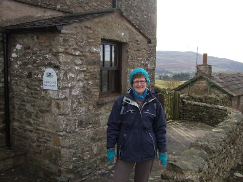
My Christmas present from Sally was a weekend away in Sedbergh. She booked it so we could go walking in the Howgills. We went up on Friday night straight after work. Sally had booked 2 nights B&B at Ash Hining Farm which is on Howgill Lane than runs along the bottom of the Howgill Fells just above Sedbergh.
A guy called Jim Mattinson runs the place and a nicer chap you could not hope to meet, a down to earth, quiet spoken bloke with a nice Cumbrian lilt. We arrive around 7PM and were welcomed in by JIm and being the only B&B guests so early in the season given a choice of rooms, we settled on the King Size with the on-suite with spa bath, we both thought this would be nice after a day out on the fells. We had a quick brew as we unpacked and then went down into Sedbergh for something to eat. We took Jim's recommendation of the Red Lion and enjoyed a good bit of banter with the locals as we ate our meals. When we arrived back at the farm Jim Had the kettle on and a nice log fire going in the sitting room where we chatted for about an hour, breakfast preferences were ascertained and we turned in at about 11pm.
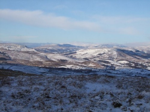
I had set the alarm for 7am and I got up as soon as it went off to see what the day was like. As we had arrived in the dark I had no idea what the view from the window would offer. I was not dissapointed, the farms position at the bottom of the fells overlooking the village has a fantastic outlook. All of the Barbon Fells back down the valley to Kirby Lonsdale to the right and Dentdale with snow covered Whernside at its head over to the left. The rivers Rawthey and Dee meeting the Lune just down the valley at Middleton. Whernside in the distance had mist but otherwise it was a clear sky, the promise of a good day. Jim cornfirmed my interpretation with his local knowledge, it might be a bit misty from time to time up in the fells but a good dry day, cool but good for walking.
We sat down to an excellent breakfast, cerial, full english, tea toast and jam. Just the job to set you up for a good walk. We finished of our breakfasts in the conservatory taking in the views and planning a route up into the Howgills, Jim added his local knowledge and suggested a few routes and alternatives we could take once up on the tops. He offered to make us a pack up for our lunch which was duly accepted. The butties were made like doorsteps and came with a bit of homemade "Cak" that his wife had made. "Thall not starve if yer get them inside thi",he said. "I might tak a bit of walk myself when Iv'e done mi tittivating".
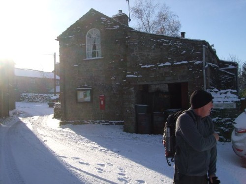
Suited and booted with rucksaks packed at about 10AM ready for the off.
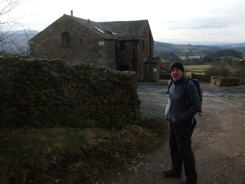
We had decided to take one of Jim's recommendations and head up the fell to the summit of Winder where further options would be available.
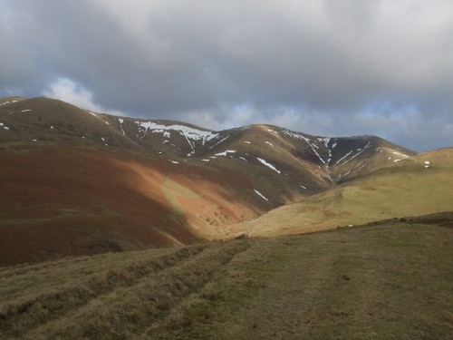
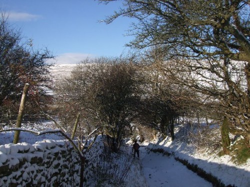
A glance back to the Farm from Howgill Lane
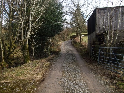
200 yards further along the lane and we reach one of the entrances to the fell
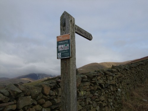
The Howgills are formed from Silurian rock, the thin top soil has no clay or peat and will only support short grass so is predominantly dry underfoot. The name comes from the old norse haugr for hill or barrow and gil for valley, a perfect description for this collection of undulating rounded hills and steep sloped valleys linking them. All of the Howgills are designated open access, a few walls on the lower slopes but otherwise completely open ground with freedom to roam.
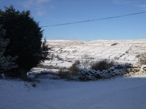
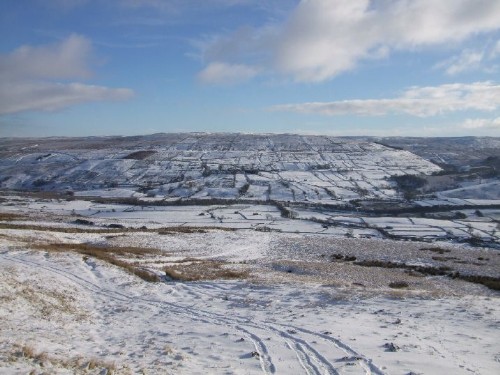
This is the view from the top of the access lane up onto the fells towards Winder.
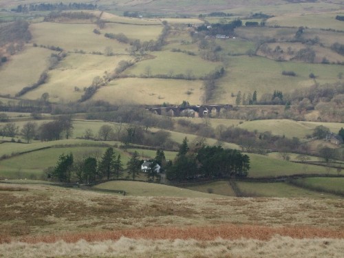
About half way up we look back into the valley below and see the viaduct on the old disused railway line.
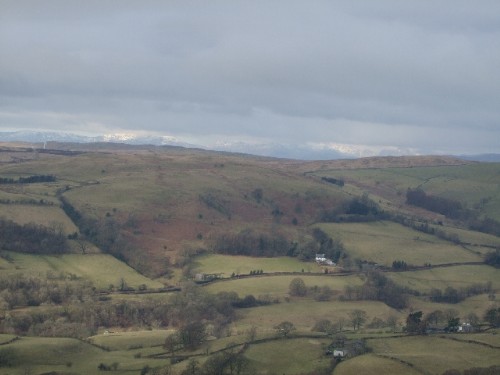
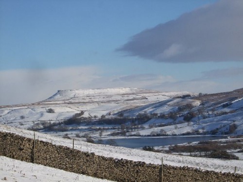
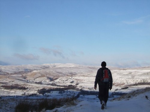
Out to the North West the snow covered Lakeland fells are coming into view.
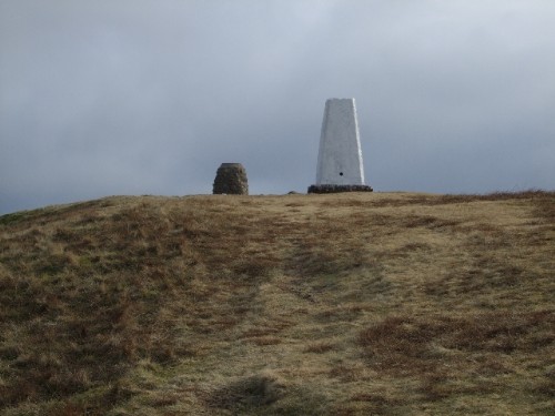
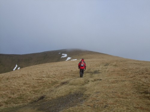
Approaching the summit of Winder with the Trig Point and Obelisk in view.
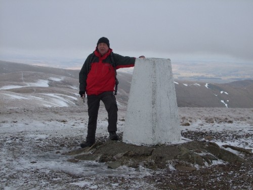
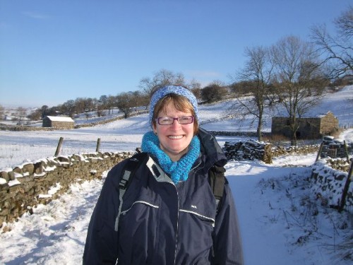
Sally at the Trig Point.
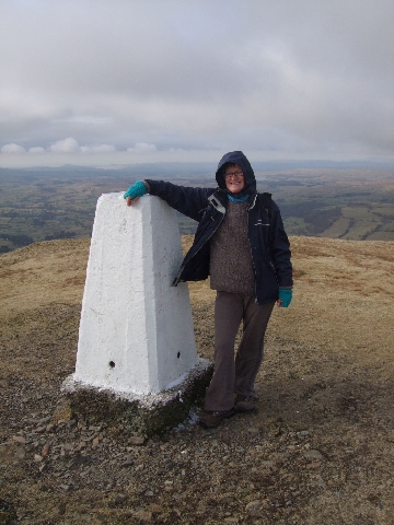
The summit of Winder (1551ft) has a sighting Obelisk alongside the trig point, the summit affords 360 degree panoramic views of the surrounding areas.
I think it's this way!
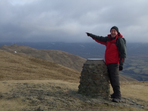
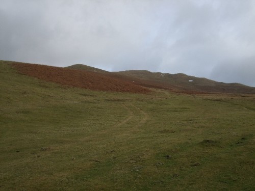
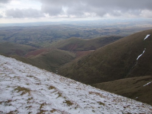
Arant Haw is our next target, the obelisk says it is 2miles to the summit, looking at the path from here it's going to be a steady climb all the way.
Setting off to Arant Haw.
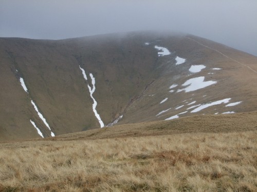
The summit of Arant Haw has no trig point it is marked by a small stone cairn where the fell top levels off at 1989ft. The fell is quite open at this point and there is a stiff biting wind, a mist has started to descend but we decide to carry on forwards to Calders. The path is clearly defined here and we can always retrace our route if the weather and visibility deteriorates too much.
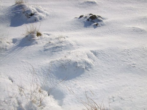
The mist starts to lift and clears as quickly as it descended. As we reach the half way mark to Calders, there is a sheepfold just below the level of the path.
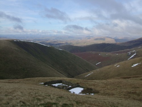
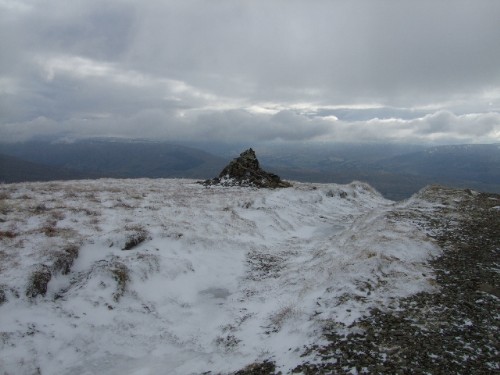
A half mile further on and we reach Calders where a number of paths converge, marked by another cairn at 2200ft.
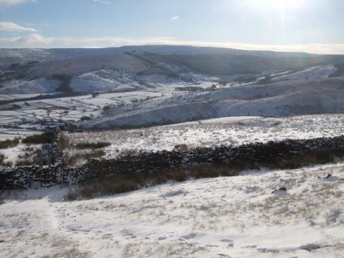
We could turn right here and take one of the paths back down the fell via Middle Tongue summit or continue further to the East via Great Dummacks to Cautley but this would take us quite a way out of Sedbergh with a long treck back up into the village and a further 2 miles back to the farm. Better to push on forwards and look for a route down a ridge to the West. A quick check of the map shows a couple of options so we carry on forwards towards The Calf.
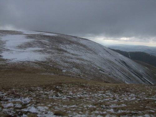
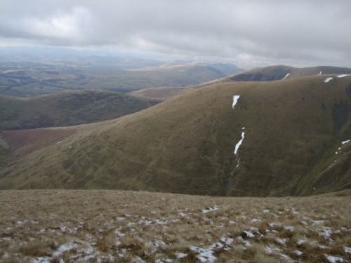
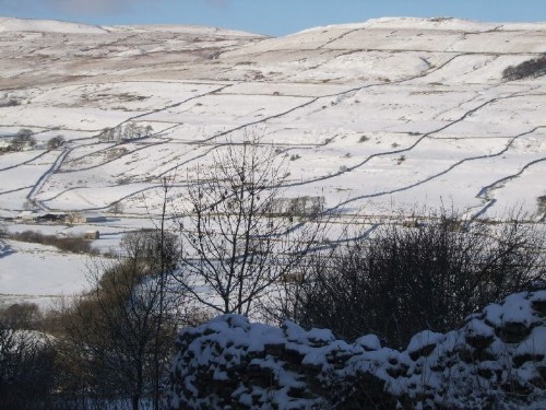
Looking back down from Calders towards Arant Haw
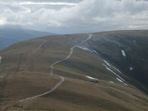
Over the next mile from Calders, the path descends steadily then climbs again steeply back up to 2200ft at Bram Rigg.
Starting the Climb to Bram Rigg Top.
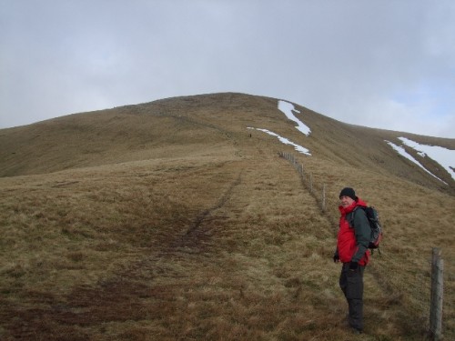
We take a breather on the climb and looking back down the slope see a man striding with purpose ascending behind us. He is walking briskly up the hill and it soon becomes apparent that this is our host Jim complete with flat cap, a-la Wainwright, although he is a tad older than me, you can tell from his stride that he has done this many times before. "Third time this week", he says, as he slows down to our pace on the climb. We stay together for the next mile or so and we chat about the various options for the return journey. The approach to the summit of The Calf has a fair covering of snow and we get another brief spell in the clouds as the mist comes down again.
Cairn at Bram Rigg.
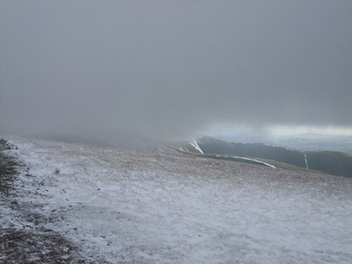
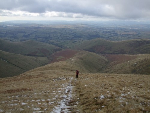
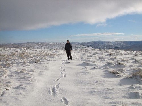
As we approach the trig point Jim says his farewells and picks up the pace, he he walks once round the trig and is now on his way back down. As he passes us he says, "I'll put the kettle on for when you get back". By the time we get to the trig he has dissapeared back into the mist. We are alone on the Calf, which is the highest summit in the Howgills at 2220ft.
Head in the Clouds.
The mist starts to clear again as we trace our steps back down to Bram Rigg Top. Jim had pointed out a path down the ridge from here that would eventually lead us back to Howgill Lane about a mile from the Farm.
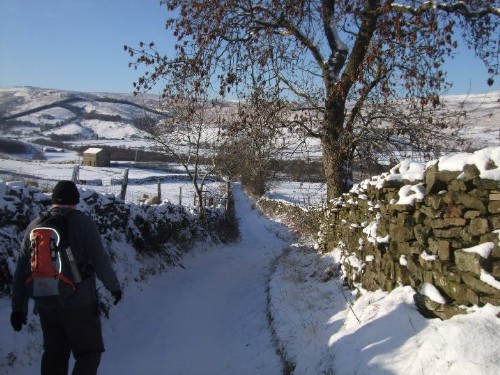
Path along side of fell.
Approach to sheep path.
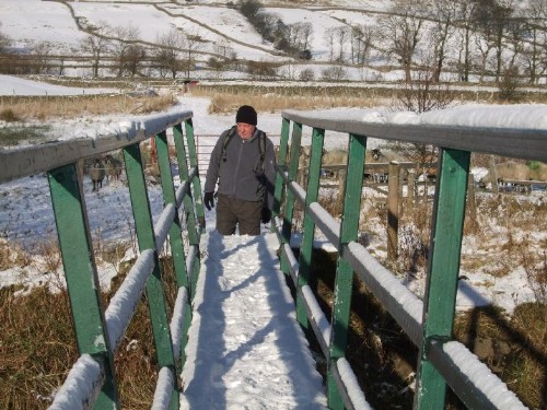
Access to the ridge was via a sheep path that clung to the side of the fell. It was covered in snow with a sheer drop to the right into the valley below with Calf Beck at the bottom. The contour lines on the OS map show the beck about 400ft below the level of the path. The path was ok until about half way along the side of the fell, the remaining snow on the side of the hill had completely obliterated the path for the last hundred yards. We could see a snow free path beyond so decided to climb up above the snow line and traverse across slightly further up the hill. It was a bit of a steep scramble but a lot safer than the direct route.
Other side of snow obstruction on to green grass again.
We had walked our breakfast's off by now and as soon as we got on to the snow free grass we sat down for our butties and a brew.From here we could see the route all the way down. Along the top of the next couple of hills and then the path cuts through the brakcken on the side of the hill and eventually ends in the valley bottom.
Halfway down in Bracken with sheepfold ahead
There is another sheep fold in the bottom of the valley where a number of becks converge. These in turn join other tributaries from the Western side of the fells which all feed into the River Lune. Down in the bottom of the valley we have to traverse the becks 3 times before rejoining the path again to climb the next fell.
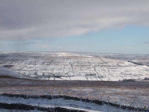
The path clims steeply for about half a mile out of the valley and then clings to the 900ft contour around Swarth Greaves.
Other side of beck - view back up to The Calf and Bram Rigg from side of Swarth Greaves.
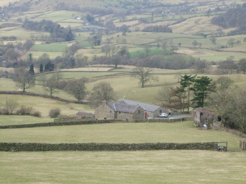
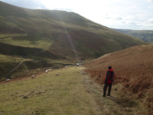
The path climbs steeply back to about half way up the side of Swarth Greaves and hugs the 850ft contour round the hill eventually exiting the fell just above Birkhaw Farm. We are back with field boundaries now and have just a couple of fields to cross and a short lane before dropping down into the farmyard.
We exchange pleasantries with the farmer who is hosing down his Land Rover in the yard. Another quarter of a mile and we are back on Howgill Lane.
View from lane to Birkhaw Farm.
This section of the back road is straight as a die and is built on top of a previous Roman road. A mile further on and we are back at Ash Hining.
This circular is about 8 and a half miles of pleasant walking with fantastic views, lots of ups and downs and rated as strenuous, some difficult bits to contend with but that was by choice of route and the prevailing conditions.
GMaps route is here:
http://www.gmap-pedometer.com/?r=3476576
Back at the Farm, Jim had the kettle on as promised, tea served with more cake then a wind down in the spa bath, a good day all round.
Edited by - panbiker on 17/02/2010 20:28:44
Ian |
gus
|
Posted - 17/02/2010 : 23:01
Another great walk ian, i really enjoyed that. I have never done the Howgills, and now look forward to having a go .......
Gus
http://www.flickr.com/photos/angusbrennan/
|
Stanley
Local Historian & Old Fart
36804 Posts
|
|
Posted - 18/02/2010 : 06:42
A Full English would go down well after that! Well done Ian, an interesting piece.
Stanley Challenger Graham
Barlick View
stanley at barnoldswick.freeserve.co.uk |
Another
Traycle Mine Overseer
6250 Posts

|
|
Posted - 18/02/2010 : 07:51
Thanks for a good informative read panny. Nolic
" I'm a self made man who worships his creator"  |
Cathy
|
Posted - 18/02/2010 : 08:13
Great read Ian and wonderful photo's, thanks.
All thru the fields and meadows gay .... Enjoy
Take Care...Cathy |
panbiker
|
Posted - 18/02/2010 : 12:25
Thanks for your comments. Sally took most of the photo's on this trip. It's about 20 years since we were last up in the Howgills. I want to do the Eastern side now around Cautley. There are so many routes on those fells that you are spoilt for choice. I came across a fell running site on the net which has a route to summit all 41 of the fells in the Howgills. It is used by many for training. The open access to the area is particularly appealing as you can please yourself where you go. We will almost certainly be re-visiting and a lot sooner than 20 years most likely!
Ian |
gus
|
Posted - 18/02/2010 : 19:05
Ian a neighbour of yours, Raymond Pickering, has done Cautley spout, I think its called, if you see him he can tell you all about it.
Gus
http://www.flickr.com/photos/angusbrennan/
|
panbiker
|
Posted - 18/02/2010 : 21:43
Yes Raymond gets about a bit doesn't he. I have done Cautley Spout also Gus but a long time ago. It's best seen after heavy rain. I would like to explore a bit further beyond. It gets a lot of visitors as it is the highest waterfall in Britain (above ground). Greatest unbroken drop waterfall is the spill into Gaping Gill on Ingleborough. Something else I have promised mysef to get round to doing, (go down on the winch) setup by the fell rescue guys, I think at Easter. Tale goes that the journey down into the chasm is free, you pay to get back up!
Ian |
Grockle
New Member

16 Posts

|
|
Posted - 12/11/2010 : 12:42
another great thread,Mrs Grockle did the Penine Way last year with a friend,a feat in it's self ,but she broke her back in an accident at work the previous year.
I was born to late for my interests. |
belle
|
Posted - 12/11/2010 : 13:27
Grockle, you post is so encouraging to someone like me who has just been diagnosed with degenerative spine problems, maybe there is hope for me to do some of the things I have always dreamed of yet! Walking the penine way was one of them. Tell Mrs Grockle what a fantastic inspiration she is!
Life is what you make it |
Grockle
New Member
16 Posts
|
|
Posted - 12/11/2010 : 13:42
thanks belle,I'll pass on your regards,I hope you can achieve your ambitions,if your ever in Derbyshire let me know
all the best
Roger(Grockle)
I was born to late for my interests. |
panbiker
|
Posted - 12/11/2010 : 17:00
You have few hills to go at then Grock just like us a bit further up the chain. Well done to Mrs Grock, I fancy the coast to coast before I get too long in the tooth. My wife and myself have discussed this as a holiday option for some time in the future. Glad you enjoy the thread.
Ian |
panbiker
|
Posted - 30/11/2010 : 21:37
On the 28th December 1790, Robert Lambert, batchelor of the chapelry of Stalling Busk married Martha Outhett spinster of the same chapelry. They were married by licence with the consent of friends. Robert and Martha's marriage entry shows John Lambert to be Roberts father. John is my most distant known relative and apart from this entry in the parish register I know little else about him, I would assume he would have been born sometime around 1730-40. John had 5 children that I know of, Robert was the second of three sons and after his marriage to Martha in 1790 they produced 10 children that I know of between 1791 and 1811. All of the children were born in Marsett or Stalling Busk. With all the children being born in the vicinity, I would also assume that Robert lived his entire life in or around the two hamlets as he died in Marsett on the 20th October 1844. He gave his occupation to the 1841 census enumerator as Mole Catcher and his age at that time as 75 years. Again an assumption but I would think that he would have occupied one of the cluster of farms that make up the hamlet of Marsett to bring up his family.
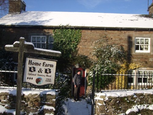
My birthday treat this year from my wife Sally was a weekend stay in Stalling Busk which I have already noted in the Winter thread on the site. We went up on Friday afternoon and stayed until mid morning on Sunday. We crept into the hamlet on Friday just as the snow started to fall in Raydale. We stayed at Home Farm which is a working farm and B&B. Only 7 of the dwellings in Stalling Busk are occupied and Home Farm is the only accomodation in the hamlet and which I would recommend to anyone wishing to stay in the area.
A nice evening meal and an early night followed and we awoke in good time for breakfast. I looked through the curtains early on Saturday morning to 4"- 6" of snow, there was wall to wall blue sky with hardly a cloud in the sky, the sun was shining and it would have been criminal not to take advantage of the conditions for a good walk on the fells.
In addition to the O.S map of the area I always have one of the series of Stile Maps which are re-drawn from the OS maps at 2.5" to the mile, these have been painstakingly reproduced by Arthur Gemmell, J Ralph Bradley and others and are available for many areas of the Yorkshire Dales, Lakeland, Howgills and many of the popular established long distance paths. All are plain white maps with just the information you need as a walker or rambler, grid lines, field boundaries, rivers, streams, all known footpaths are shown in red, types of stiles to look for and other landmarks such as field barns, copses and plantations. Various routes are given on each map as suggested walks with distances and descriptions of the landmarks on each route.
So over a hearty breakfast of cerial and orage juice followed by 4 rashers of bacon, 2 sausages, 2 eggs and 2 tomatoes, with toast, jam and tea we planned our route for the day. We were intending to do a circular of Semer Water but ultimately decided to walk over through Marsett and up over Wether Fell and the Cam High Road and down into Gayle on the other side of the fell.
Sally's cousin Anne lives in Gayle and we thought we would call for a brew if they were in. I made up our flasks for the day in the farm kitchen, the heat from tha AGA that had produced our breakfast kept the two aged black retreivers curled in front on the rug nice and warm in their old age. Maureen and Bill who run the farm have a sensor on the barn wall outside that feeds a mini digital weather station display in the kitchen. A scan of this confirmed what I expected from the view out of the window, no clouds showing or predicted, virtually no wind and a temperature of -5C, perfect conditions as long as you are prepared with the right gear. Suitably togged up we donned our rucksacks and made our way round the back of the farm to pick up the old track to Marsett.
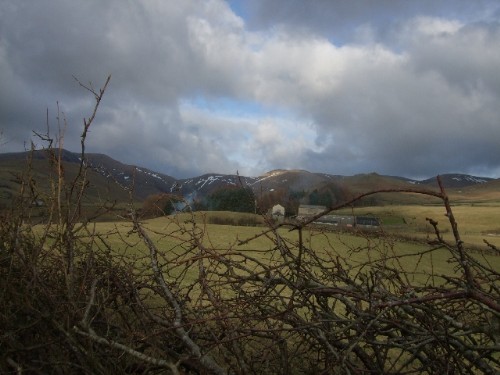
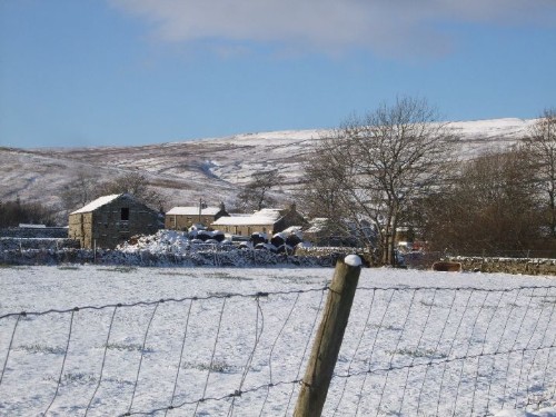
The view from the back of the farm out over Marsett and Wether Fell beyond.
This zoomed view shows the track that we will take out of Marsett to access the fell.
The track between the hamlets is narrow and you can see that it would only just be wide enough for a horse and cart or foot traffic. This is my first visit to this path, I wonder how many times my predecessors trecked it?
The track is quite low down below the level of the walls
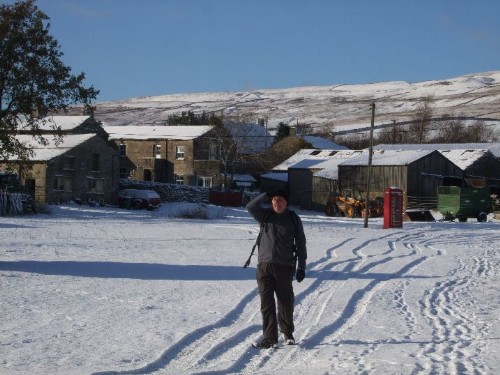
Here's Sally wrapped up for the cold, smiling as usual.
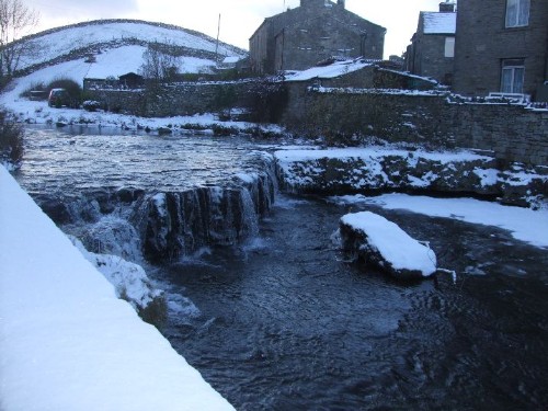
Raydale Beck one of the tributaries that converge to form Semer Water which is a natural lake.
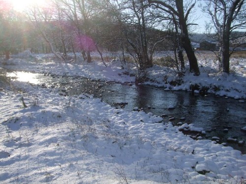
The crystal clear waters of Raydale Beck under the bridge.
The River Bain (which gives Bainbridge it's name) starts at Semer Water. It feeds directly into the Ure just to the north of Bainbridge and is only about 2 miles long making it the shortest named river in England.
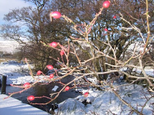
This is the bridge over Crooks Beck another feeding tributary.
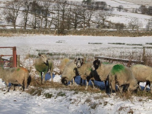
These girls are mum's in waiting.
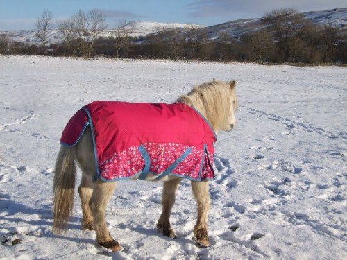
We liked the fancy waiscoat on this pony.
This is the view back to Stalling Busk from the approach to Marsett.
Hamlet of Marsett, slightly larger than Stalling Busk but not by much, still only a single road in that terminates here.
I look round and wonder which one Robert and maybe his father John used to occupy, I am standing where he lived all of his life, the best part of 200 years ago and produced 10 children who would have also played in this space, laiked in the beck and run in the fields.
Welcome to Marsett
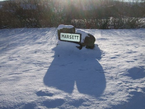
Now I know I have looked at the map and the sign just outside Marsett is fairly plain to understand but I have the feeling that I know exactly which way to go without reference to either.
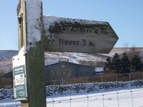
The sign does slightly underestimate the distance but there is no getting away from the fact that the next 1-2 miles is all uphill and pretty steep as well! As we leave Marsett we get a good view of Addlebrough which rises to 476M (1564ft) and is at the head of the Raydale Valley just to the South East of Bainbridge.
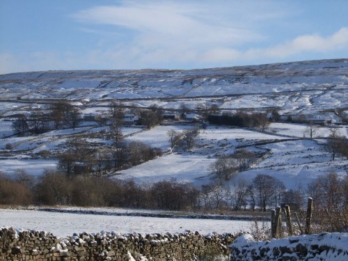
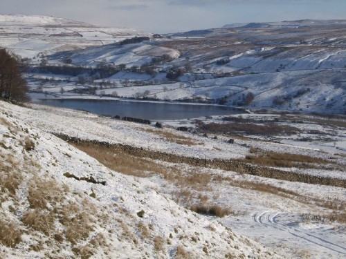
A little further up and the whole of Semer Water comes into view.
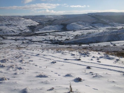
We have passed the top of the track and left the last field barn behind and are now about half way up the fell. The first view looking back shows Stalling Busk in the centre of the picture. The map shows two paths up onto the fell, one which goes up the fell diagonally to the left is described as "indistinct", we would probably have no chance of picking it up through the snow cover. Looking at the other path shows a ladder stile over the wall of the very top field boundary on the fellside so we decide to attack the hill straight on and head for this.
This view shows the view back down towards Marsett. You can see in the previous picture and this one that we are not quite the first up to this level this morning. The farmer has been out with feed for the sheep on his quad bike.
We are still in rough pasture here and still within walled field boundaries. Evidence of mouldywarps going about their business, older mounds along with a fresh one excavated this morning. Robert would have plied his trade of later life up here and in the lower pastures no doubt. I wonder what a mole was worth in 1841, a penny maybe and the skin?
Top side of the ladder stile we were aiming for, notice the dog gate through the wall at the side of the stile. Notice also that our footsteps show that we are now the first and highest on the fell.
Made it! here we are on the top of the fell, the path descends slightly from here and intersects Cam High Road which is the Roman Road that runs literaly straight as a die for at least the first 4 miles out of Bainbridge out across the top of the fell and then on over the top of Green Side (541M), between Dodd Fell (668M) and Oughtershaw Side eventualy joining what is now the B6255 Ingleton to Hawes road at Gearstones just north of Ribblehead. The B6255 from here is built over the Roman Road as far as Chapel le Dale, the Roman Road continues all the way down towards Ingleton and intersects with the Roman Road running North from Ribchester.
Here is a view looking back having just crossed Cam High Road and starting to climb slightly before the descent into Gayle or Hawes. Stalling Busk is just to the left of centre in the picture.
The view from the top, Pike Hill and the expanse of Cotterdale Common beyond come into view.
Down we go, not far from here we both managed to slip and fall on hidden ice at the side of the track under the snow. We were on a fairly steep gradient but on a defined track. Should have known better and walked in the rough on the banking but ended up on our backsides instead. Sally has a bruise on her thigh and I managed to knock the middle finger on my right hand to one side trying to break my fall, graze my forearm and skin and bruise my elbow. The finger is stiff and swollen slightly now but not broken, just badly bruised which makes it a bit sore when I try to bend it. It will mend up with a bit more time and hopefully will teach me to look where I am putting my feet.
The rest of the descent was uneventfull as we made our way down through the field system of pastures (greener on this side of the hill than the other) to eventually arrive in the village of Gayle.
Fortunately Sally's cousin was at home and made us a nice brew with biscuits. We spent a bit too long chatting, it was nice and warm in the converted barn they live in. The light was fading fast as the afternoon passed and it would have been foolish to attempt a return over the fell. Anne's husband Kevin kindly agreed to run us back around the hill in his 4 x 4 truck in time for a nice muscle soak bath and a welcome farmhouse evening meal, just as generous as the breakfast and eaten with the company and chat of our hosts Maureen and Bill along with a nice bottle of red.
A nice walk in the footsteps of family, a good healthy workout, a daliance with current family, stunning scenery, a lovely meal, hospitality and banter with the locals and an open coal fire in the farmhouse, what more could you ask for?
Edited by - panbiker on 30/11/2010 22:54:35
Edited by - panbiker on 05/12/2010 14:15:54
Ian |
gus
|
Posted - 30/11/2010 : 22:36
Ian, I remember walking around Semer water with Ray Pickering and another friend, I particularly remember going through Marsett, and how isolated it seemed to be. I also remember passing an old church circa 1770 ( derelict) very near Stalling Busk Building and graveyard not far off the side of Semer Water and not far from Marsett, could be some of your ancestors are resting there.We were all wondering how they managed to get the dearly departed to the graveyard as there was no obvious road in or out, It was a lovely walk, and one i must do again, thanks for the memories ..
Gus
http://www.flickr.com/photos/angusbrennan/
|
|
|
|
|